
Canfield Mountain Natural Trail (West)
4.8(92)google
HikingMountainScenic Lookout
Overview
Canfield Mountain is a forested ridge on the eastern edge of Coeur d'Alene in Kootenai County, northern Idaho, United States. The highest point, often labeled West Canfield Butte, reaches about 4,162 feet (1,269 m) above sea level.
Practical Info
Every day5:00 AM – 11:00 PM
Suggested Duration1-2 hours
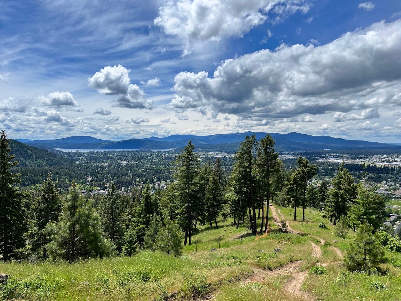
Best TimeMay-June for mountain wildflowers and September-October for crisp, cool trail runs. Arriving at the West trailhead between 6:00 AM and 8:30 AM is highly recommended; the initial ascent is steep and partially exposed, so the morning chill maximizes your energy as you climb the ridge for panoramic views of the entire Coeur d'Alene basin.
Getting ThereDeep within national forest boundaries; zero transit availability. Driving is essential: from Coeur d'Alene, navigate north on N 4th St, turn right onto E Shadduck Lane, turn left onto N Copper Drive, and follow the partially unpaved, gravelly Forest Road 233 carefully for 1 mile up to the primitive West Trailhead clearing.
Travel Tips
- This network is heavily populated by motorized dirt bikes and downhill mountain bikes; hikers must immediately step off the trail tread when hearing engines.
- The west exposure provides zero forest canopy shade, causing extreme heat and rapid trail dehydration; carry a minimum of 2.5 liters of fluid per trekker.
- The trail matrix is highly decentralized and poorly signed with many blind forks; download topological maps onto offline GPS systems before climbing.
Reviews
Positive
- An absolute paradise for dirt bikers and mountain bikers, loaded with challenging dirt inclines and sharp hairpin turns.
- As elevation rises through dense pine forests, several open clearings reveal breathtaking views of Lake Coeur d'Alene below.
- Completely free of admission or parking fees; its raw natural state is preserved beautifully, letting you fully submerge in quiet woods.
- The intricate trail network offers various routes of different lengths and grades, satisfying everyone from newbies to hardcore riders.
Heads up
- Since it allows ATVs and dirt bikes, engine roars are loud; pure hikers seeking absolute serenity on a walk will be disappointed.
- Heavy motorized traffic tears up the soil, leaving deep ruts and loose shale on trail surfaces, creating significant ankle-twisting risks for walkers.
- Signage or route maps on the mountain are primitive and weather-damaged; it's easy to get turned around at forks without active GPS.
- The trailhead base lacks basic infrastructure; no proper restrooms, no water refill stations, and the parking zone is quite chaotic.