
DeSoto State Park
4.8(2.8K)google
4.3(40)yelp
NatureOutdoor
Overview
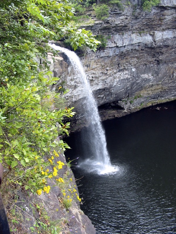
DeSoto State Park is a public recreation area located on Lookout Mountain, eight miles (13 km) northeast of Fort Payne, Alabama. The state park covers 3,502 acres (1,417 ha) of forest, rivers, waterfalls, and mountain terrain. It borders the Little River, which flows into the nearby Little River Canyon National Preserve. The 104-foot-tall (32 m) DeSoto Falls, the state's highest waterfall, is found in a separate part of the park six miles (9.7 km) north of the main park.
Practical Info
Every day9:00 AM–9:00 PM
Suggested DurationAbout 4-6 hours
Best TimeMay is the best time to see wild azaleas and rhododendrons in bloom. Mid-to-late October and early November offer beautiful autumn foliage and crisp, pleasant weather for hiking.
Getting ThereLocated on Lookout Mountain, about 8 miles northeast of downtown Fort Payne. Accessible by car via AL-35 to County Road 89 (DeSoto Parkway), leading directly into the park.
Travel Tips
- North of Little River Canyon, famous for wildflowers, dense pine forests, and hidden waterfall network
- Centerpiece: 104-foot DeSoto Falls with classic viewing platform overlooking cascades
- 25+ miles professional mountain trails, stroller-friendly boardwalks
Reviews
Positive
- The sight of DeSoto Falls plunging into the canyon is spectacular. The rustic cabins are charming, the pine-scented air is refreshing, and the well-maintained boardwalks make exploring easy.
- A pristine natural retreat with exceptionally fresh air.
Heads up
- Mountain roads are very dark at night due to the lack of lighting, and wildlife such as deer frequently cross the roadway. Night driving requires extra caution.