
Devils Punchbowl State Natural Area
4.7(5.7K)google
4.6(112)yelp
Scenic LookoutFamilyOutdoorPhoto SpotOcean ViewFreeCoastRock Formation
Overview
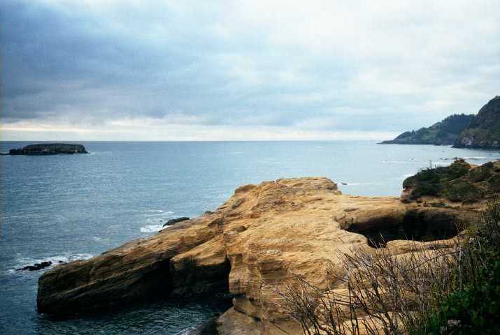
Devils Punchbowl State Natural Area features a massive, hollow rock formation carved out of the rugged coastal headland where the ocean relentlessly crashes inside. Formed by the collapse of the roof over two sea caves, the punchbowl churns and foams violently with incoming tides and winter Pacific storms. During low tide, adventurous visitors can carefully hike down inside the bowl to examine its unique rock layers, marine geology, and tide pools. The cliff tops serve as an excellent, elevated vantage point for watching the ocean's power and spotting migrating gray whales.
Practical Info
Suggested Duration1-2 hours
Best TimeOpen year-round with complimentary access. The definitive experience relies strictly on two contrasting tidal cycles. To witness violent maritime drama, visit during a stormy high tide when massive Pacific swells crash and churn furiously inside the rock cauldron. To explore the interior floor, monitor tide charts for an extreme minus low tide window, allowing you to walk right inside the open-air sea cave chambers.
Getting ThereSituated in the coastal community of Otter Rock, roughly 8 miles north of Newport. Driving is straightforward: from coastal US-101, turn west onto C Avenue at the Otter Rock markers, and follow it for half a mile to the cliffside loop at 1st Street; a small, free municipal parking field sits right adjacent to the rocky overlooks. Because spaces vanish rapidly on summer weekends, arrive early; no city transit routes run here.
Travel Tips
- Entering the floor of the bowl on foot is only physically viable during extreme negative low tides (NOAA status below 0.0 ft) for a narrow 45-minute window via Otter Rock beach. As the tide shifts, violent incoming Pacific surges refill the cavern with treacherous vortex currents. Climbing down the perimeter cliff fencing outside safe low-tide windows results in high drowning risks.
- The primary clifftop scenic lot is extremely microscopic, holding fewer than 15 standard vehicles, and interfaces with a narrow residential one-way loop. Motorhomes or pulled trailers exceeding 20 feet are logistically gridlocked here due to zero physical turning radii; oversize drivers must park in open roadside turnouts along nearby US-101 before entering.
- The viewing headlands are comprised of loose, unstable sandstone subject to unannounced sudden chunk failure caused by relentless surf undermining. Crossing safety guardrails to access cliff edges for selfies is dangerous and illegal. Because pelagic birds nest across these vertical walls, civil drone deployment is completely banned.
Reviews
Positive
- Striking coastal geological impact! The massive hollow rock formation resembles a boiling bowl where violent ocean waves roar and churn grandly.
- Elite intertidal fun! Low tide lets you safely walk down inside the bowl itself to view colorful starfish and tide pools close-up. Highly lived up.
- Zero entrance fee required. The private parking lot is small but free, equipped with flat accessible viewing platforms and sharp signage with great value.
- Set right off coastal Highway 101, driving transit convenience is flawless, bordered by local wineries and seafood shacks for a perfect quick road stop.
Heads up
- During high tide or storm surges, violent crashing waves flood the entire stone bowl, causing security to lock the access paths, limiting you to distant cliff views.
- The dedicated free parking lot is tiny, holding around 20 cars. Summer peak afternoons gridlock the narrow single-lane access street with circling vehicles.
- The step trail down to the marine floor consists of slick, mossy jagged rocks with zero accessible ramps, proving highly challenging for mobility-impaired guests.
- The natural stripe is quite small, functioning as a 30-minute quick stop. Restrooms are weathered, and it lacks picnic shade pavilions.