
Dry Falls
4.9(1.1K)google
4.9(83)yelp
WaterfallRiverForestHiking TrailScenic LookoutSenior-FriendlyOutdoorPhoto SpotFreeMust-SeeLocal Favorite
Overview
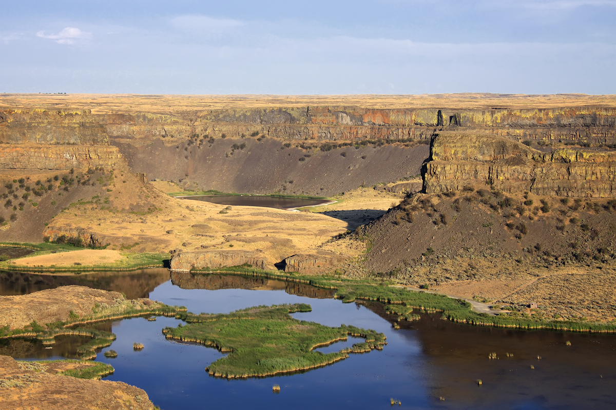
Dry Falls is a 3.5-mile-long (5.6 km) scalloped precipice with four major alcoves, in central Washington scablands. This cataract complex is on the opposite side of the Upper Grand Coulee from the Columbia River, and at the head of the Lower Grand Coulee, northern end of Lenore Canyon. According to the current geological model, catastrophic flooding channeled water at 65 miles per hour (105 kph) through the Upper Grand Coulee and over this 400-foot (120 m) rock face at the end of the last glaciation.
Practical Info
Suggested Duration45-75 minutes
Best TimeLate spring or October represent the peak seasonal windows. Hike down between 8:30 AM and 10:30 AM when the morning sun penetrates the deep gorge, lighting up the mist. The trail takes you directly behind the roaring 65-foot waterfall wall without getting drenched.
Getting TherePerched in the spectacular Cullasaja Gorge just northwest of Highlands along US Highway 64 (US-64 W). Drive 3.5 miles northwest from the town center; the paved forest service parking area with automated pay-stations sits directly on the right shoulder of the highway.
Travel Tips
- Managed by the USFS; parking requires a 5-dollar daily vehicle fee paid at the automated electronic kiosk. The America the Beautiful Interagency Pass is accepted but must be displayed clearly on your dashboard.
- The narrow lot along US-64 tightly fits fewer than 20 cars and legally bans all RVs or trailers; peak overload hits from 10:00 to 15:00. The deep gorge is a total cell dead zone, requiring offline GPS mapping.
Photo Tips
Gear
- The signature trail leads directly underneath and behind the rushing water curtain; severe mist overspray leaves the stone ledge highly slick and drops water onto cameras. Bring waterproof shells and high-traction boots.
Reviews
Positive
- The 75-foot waterfall roars down the cliff, but the most stunning part is that visitors can walk on a natural cliffside trail directly behind the cascading curtain of water, delivering an authentic and highly thrilling 'water cave' visual experience.
- The trail leading down to the waterfall is paved with smooth, stable stone steps and equipped with heavy-duty anti-slip safety handrails, providing excellent safety protection and order management around the damp environment.
- Sitting tight next to the asphalt mountain highway, driving transit is highly convenient; recent expansions have added clean public restrooms and high-level viewing platforms, significantly improving infrastructure maintenance compared to the past.
- As part of the U.S. National Forest, it charges absolutely no per-person admission, requiring only a tiny parking fee per car at the self-service machine, delivering top-tier value for money to get close to nature.
Heads up
- While a perfectly paved accessible ramp leads to the upper viewing platform, due to terrain limitations, the core lower trail going behind the waterfall is full of steep, slick stone steps, making it completely impassable for wheelchairs and strollers.
- As a top hit-and-record waterfall around the Smokies, crowd density explodes severely on summer weekends and during the autumn foliage season; the narrow trail behind the water is packed with crowds, making it hard to take photos in a noisy vibe.
- The waterfall surroundings are shrouded in thick mist year-round, and walking on the back trail easily leaves you thoroughly soaked by flying spray; it can feel highly inconvenient without self-prepared raincoats, jackets, or waterproof gear for cameras.
- The dedicated scenic parking lot is extremely limited in size, holding only a few dozen cars; slots are in severe short supply during peak hours, forcing late-driving tourists into long queue waits along the narrow mountain roads, harming transit convenience.