
Mount Bonnell
4.6(2.2K)google
HikingFree
Overview
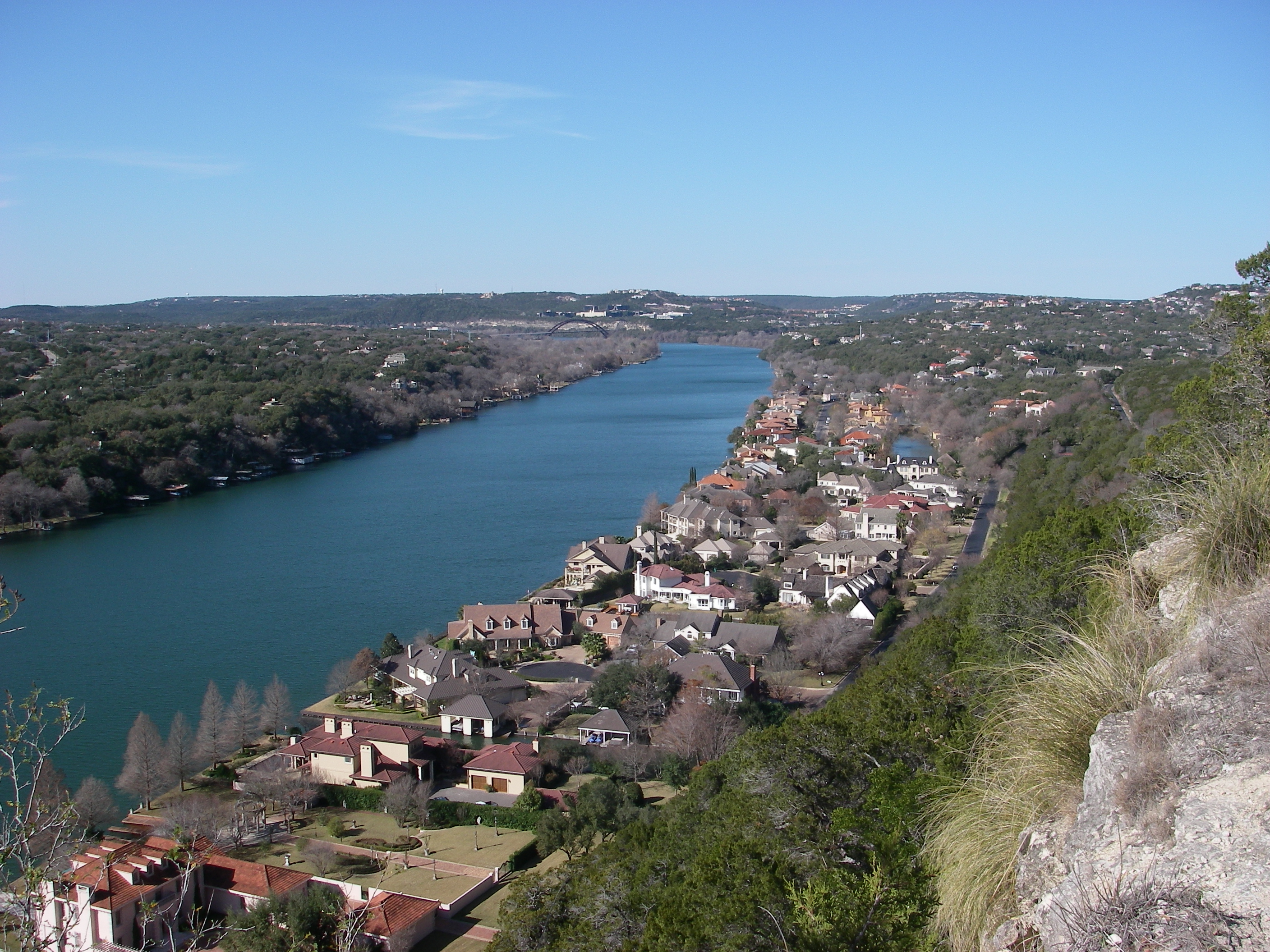
Mount Bonnell, also known as Covert Park, is a prominent point alongside the Lake Austin portion of the Colorado River in Austin, Texas. It has been a popular tourist destination since the 1850s. The mount provides a vista for viewing the city of Austin, Lake Austin, and the surrounding hills. It was designated a Recorded Texas Historic Landmark in 1969, bearing Marker number 6473, and was listed on the National Register of Historic Places in 2015.
Practical Info
Every day5:00 AM – 10:00 PM
Suggested Duration30 minutes
Best TimeMagnificent year-round, but a clear evening from 5:30 PM until dark is globally recognized as the absolute pinnacle window. Scale the historic limestone steps (elevation 775 feet) to the summit ridge trails; the setting sun blankets the winding Colorado River basin and Lake Austin completely unhindered, providing the single best elevated photographic view of luxury cliffside estates.
Getting TherePerched atop the rugged limestone cliffs of northwest Austin at 3800 Mount Bonnell Rd. Driven access via car is the exclusive transport option given its steep elevation climb; navigate north from downtown via the MoPac Expressway to the 35th St Exit, travel west past Camp Mabry, and follow Mount Bonnell Road straight to the free parallel parking bays.
Travel Tips
- The summit parking strip is a notorious hot spot for targeted vehicle smash-and-grab burglaries. Before arriving, secure all backpacks, luggage, dash cams, and trailing charging cables entirely out of sight inside the trunk, leaving absolutely zero personal property visible inside the cabin.
- As an elite sunset overlook, the narrow gravel parking along Mt Bonnell Rd fills to maximum capacity by dusk; illegal parallel parking results in heavy municipal citations. Arrive 1 hour early, or pivot to a sunrise trek when dead-calm winds produce mirror-like reflections on the Colorado River below.
- Accessing the summit requires ascending 102 uneven, native limestone stairs bordered by encroaching poison ivy. Never scale the stone safety retaining walls at the top for photos; the cliffs beyond consist of loose, eroding limestone scree prone to sudden structural failure and fatal falls.
Reviews
Positive
- As one of Austin's highest points, the summit offers panoramic vistas of the Colorado River and skyline, delivering a spectacular sunset spectacle.
- It is entirely free to the public and charges zero gate fees; accessible anytime, it offers perfect value for sightseeing and quick photo stops.
- The property is easy to find via smooth driving routes, featuring free roadside parking at the base and a quick, well-maintained stone staircase.
- The pavilion at the top has retro charm; walking along the rocky limestone ridges preserves a serene calm away from urban noise for a therapeutic trip.
Heads up
- The scenery depends heavily on the weather; dense fog or rainy days ruin the visibility completely, resulting in a disappointing contrast.
- The site lacks modern infrastructure with zero public restrooms, trash bins, or elevators; steep steps render it inaccessible for strollers or wheelchairs.
- Weekend sunset golden hours trigger a huge hike in visitor density; the narrow deck gets overcrowded and noisy, and parking fills up fast.
- The roadside lot occasionally suffers from car break-ins and theft as mentioned in reviews, requiring visitors to lock valuables away.